Some novels could happen anywhere. Teton Angel couldn't. Its people are shaped by deep snow and short summers, by cattle prices and county lines, by mountains you can see from every kitchen window. The places in the book are real, and most of them you can drive to this afternoon if you're anywhere near the Idaho–Wyoming line.
Here's a reader's map of the country where the story rides.
Spoiler-light: this post sets the scene for each place without giving away what happens there.
The lay of the land
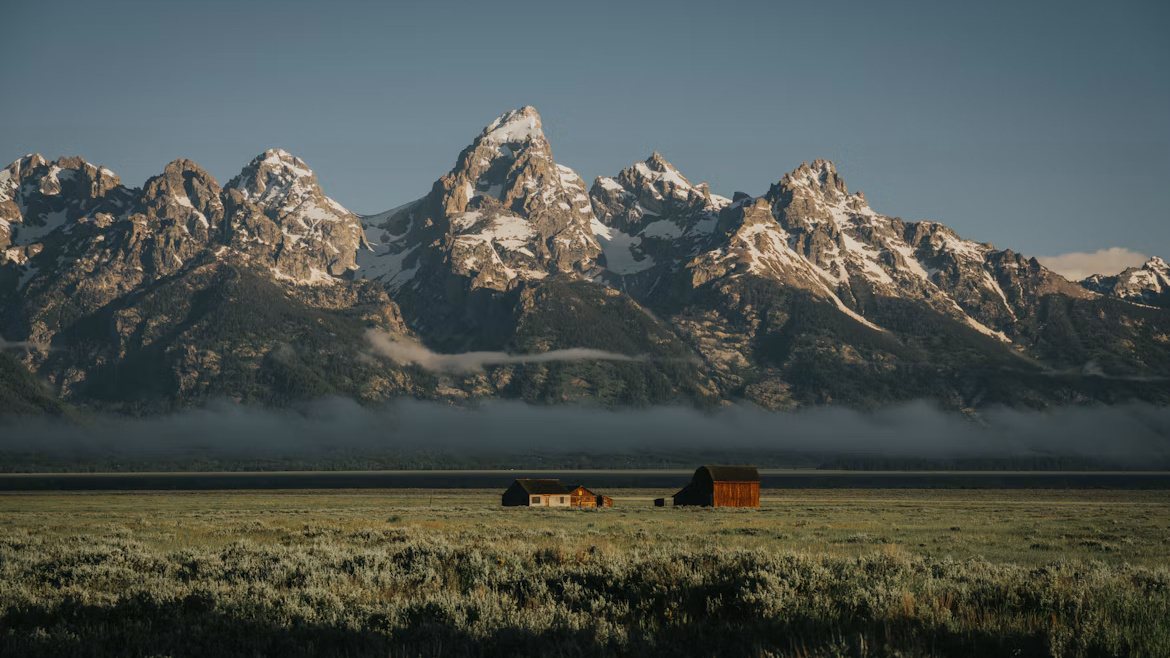
The novel lives on both sides of the Teton Range. On the west, the Idaho side, are the farm towns of the upper Snake River plain and Teton Valley: dryland grain, hay meadows, calving sheds, and towns small enough that the gas station clerk knows what you're going to buy before you reach the counter. On the east, the Wyoming side, is Jackson Hole: the valley floor beneath the peaks, the town of Jackson, and the national forest and park country beyond.
The book's opening pages describe it better than any guidebook: storms rolling in off the Pacific and breaking over the Rockies, snowpack that melts "suddenly and fiercely" in spring, and wildlife drifting south out of Yellowstone, with the predators always trailing behind.
Idaho
St. Anthony
The story opens at a gas station counter in St. Anthony, a farm town on the Henry's Fork of the Snake River. Jean Polson is on the register; her brother-in-law Kenny is buying fifteen dollars on pump three. They haven't really talked in years. One small favor, and a brown paper bag of no-bake oatmeal peanut butter cookies, start the whole book moving. St. Anthony is also where readers will find Harold's stone-cutting shop, out on the highway, with a cowbell over the door.
Driggs and Teton Valley
Just outside Driggs, under the west face of the Tetons, is the Robinson family's Circle Bar Ranch: calving sheds, a stable Conrad designed himself, and a herd whose bulls sell to ranchers as far off as Texas and New Mexico. Teton Valley is still ranch country, with the peaks rising straight up behind the hay fields. If you want to see what Conrad sees every morning, drive the valley roads at sunrise.
Victor
A few miles south of Driggs sits Victor, home in the book to Rick's Bar and Dance Hall, where Willard Robinson has a favorite stool and the whole valley keeps track of who he leaves with. Victor sits at the foot of Teton Pass, the mountain road that links Idaho's Teton Valley to Jackson.
Rexburg
Aiden Robinson once served as sheriff of Madison County, Idaho, and Rexburg is that county's seat. In the novel, a twin-engine charter touches down at the Rexburg airport with no warning to the front desk, and the reason for the hurry says a lot about who holds power in this valley.
Wyoming
Jackson Hole
For a lot of readers, Jackson is the heart of the book. It's where Aiden first served as sheriff, where Miss Leah runs the hotel that became a refuge for so many guests, and where a certain sheriff takes his usual seat at the back of a café on North Cache Drive. Jackson today is busier than the town in the book, but the bones are the same: boardwalks, western storefronts, and a Fourth of July that looks like a postcard.
"You are in Jackson Hole, Wyoming, girl. You're fine with what you have on: Levis, a western shirt, and boots."
The high country
The book's central journey is a two-week trail ride on horseback through the Teton high country: Conrad, his sons, and young Roy Polson on a borrowed horse. No map ("It's a trail ride. We just follow the signs"), clear mountain springs, an elk with six points a side, and nights camped in groves of quaking aspen. You can ride parts of this country yourself with local outfitters on both sides of the range. Just bring a map.
Highway 26 and the canyon roads
Roads matter in Teton Angel. Pickups, horse trailers, long drives home from the rodeo with the radio fading in and out between the pines. US Highway 26 runs into Jackson through the canyon country to the southwest, and anyone who has driven it after dark knows exactly why the radio signal gives out.
Rawlins
Out across the high desert in south-central Wyoming is Rawlins, where the book's rodeo story reaches its peak. Bull names drawn from a hat, a cowboy who stays on "the full eight seconds plus," and a July night nobody in the Robinson family will forget.
Planning your own Teton Angel trip
- Best season: July into early August, the same window the Robinsons pick for their ride, when "the mountain springs still ran clear and cold." Expect afternoon thunderstorms in the high country.
- Base camps: Driggs or Victor on the Idaho side; Jackson on the Wyoming side. Teton Pass connects them; check conditions before you cross.
- Sunrise shot: the old homesteads and barns on the Jackson Hole valley floor, with the Grand Teton behind them, are among the most photographed scenes in the West.
- Rodeo: small-town rodeos run all summer across Idaho and Wyoming. Go to one. Sit near the chutes.
- Pack the book: read the trail ride chapters with the actual peaks in front of you. It hits different.
And if you happen to pass a quiet cemetery on a hillside above town, with a view of the whole valley, take a minute. Look for a stone saddle. Look for a ball cap with the number twenty-one.
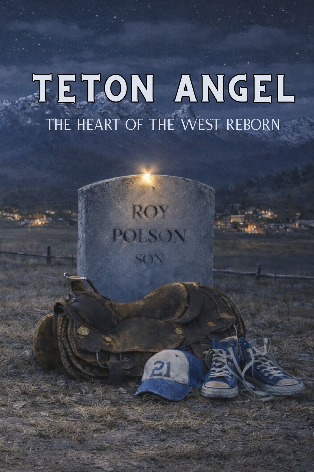
Take the trip in Teton Angel
Ride along with the Robinson family and find out who carved the stone.
Get the book →